|
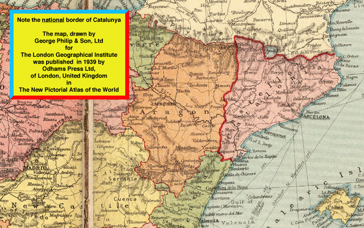
THE CATALUNYA MAP |
|
In the autumn of 1974 I bought a copy of The New Pictorial Atlas of the World from a second hand book shop in Sunderland. On pages 48-49 I found a map of the Iberian Peninsula which showed Catalunya with a national border. |
|
|
|
To see the full map click on the image below. |
 |